PRO ITER Prog. Infrastr. Terr. (73%); Studio Matildi
The modernization of the S.S. 64 'Porrettana' is mainly focused on the 2nd sector (Ca' dei Ladri-Marano) to which the design of Pro Iter - Studio Matildi refers: this sector, which is located between a sector already completed and one to be still implemented, includes areas where gravitational slope movements have mainly occurred over time (the roadway, at km 41+700 and for approx. 100m, was clearly lowered); in addition, the Reno river is visibly subject to bank erosion for long stretches along the route.
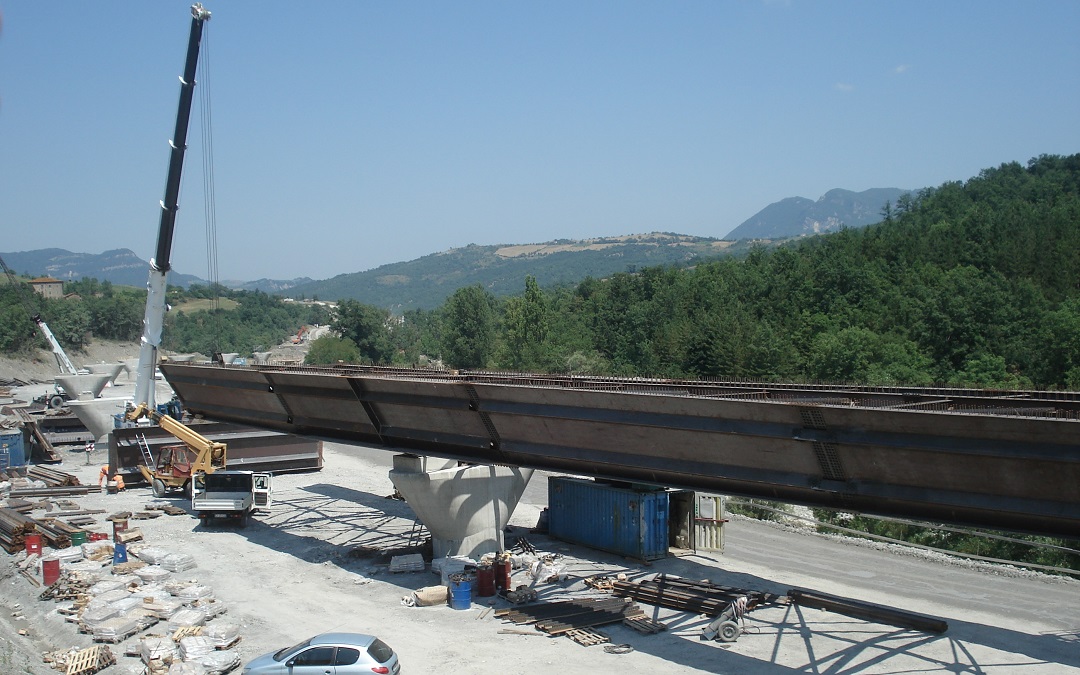
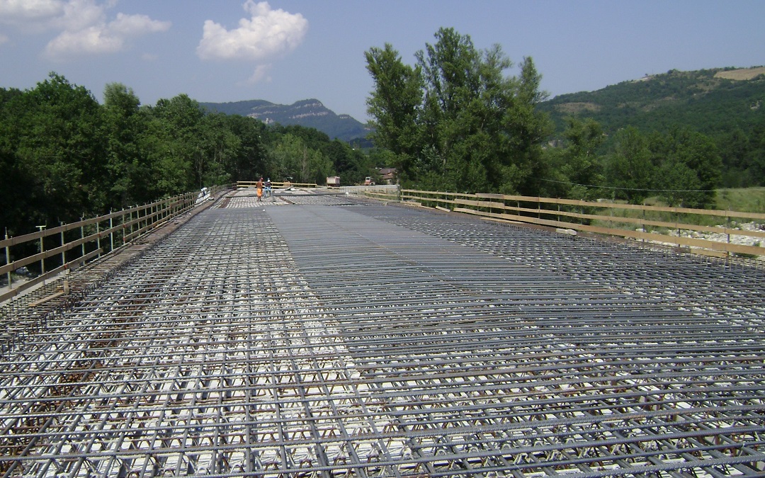
The infrastructure includes 6 viaducts with several spans, developing from 100m to 725m, three artificial tunnels, a number of supporting works such as walls and bulkheads, and a significant stabilization work of the slope subject to landslides.
ContinueImportant intervention of stabilization of the landslide slope with deep and superficial drainage system, with monitoring (Ante-Operam, during the execution of works and Post-Operam).
6 multi-span steel/cls viaducts (length between 100 m and 725 m); 2 artificial road tunnels (150 m and 270 m); extension of existing railway tunnel (L=238 m).
Retaining, counter-reinforcement and sub-reinforcement works realized in different typologies (in situ, with prefabricated solutions, with bulkheads in poles of big diameter covered).
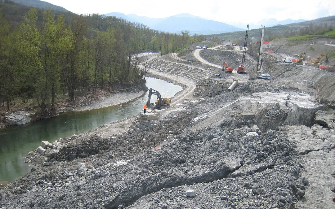
The most critical aspect of the design is the presence of an active landslide at viaduct 2bis, where the erosive action of the Reno river has soon caused gravitational movements. In order to verify its state of activity and to determine its depth and speed of movement, inclinometric pipes have been installed during the additional geognostic survey (the monitoring lasted approx. 1 year, and it continued during the entire construction phase). The designed stabilization included reinforcement works, surface and deep drainage (3 well drains and relevant draining system) and a bank protection made of boulder-size stones. A post operam monitoring was also implemented to check effectiveness of the work performed.
The longitudinal development of the route, in line with the criteria of the Final Design for Integrated Contract, is approx. 5.30 km (2.40 km viaduct, 0.50 km artificial tunnel and 2.40 km open air). The junctions in Grizzana and Marano are also included, which have been rationalized during execution to limit the burdensome and problematic adaptations of existing works, as well as to adapt to the changes of altitude of the route (necessary according to the hydraulic compatibility study performed).
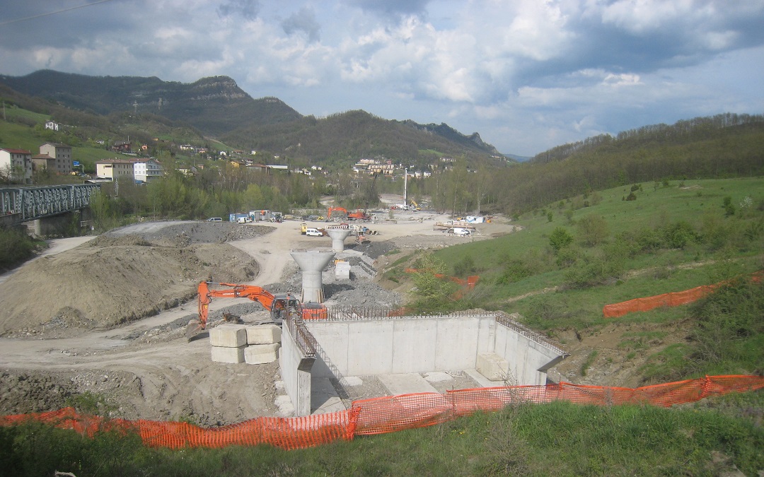
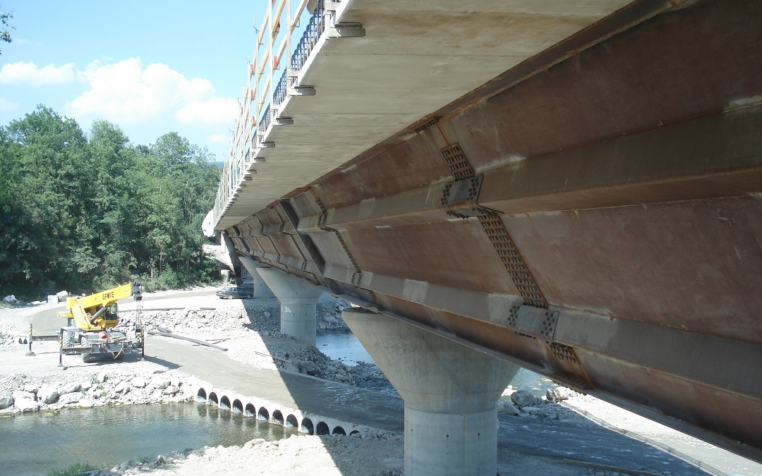
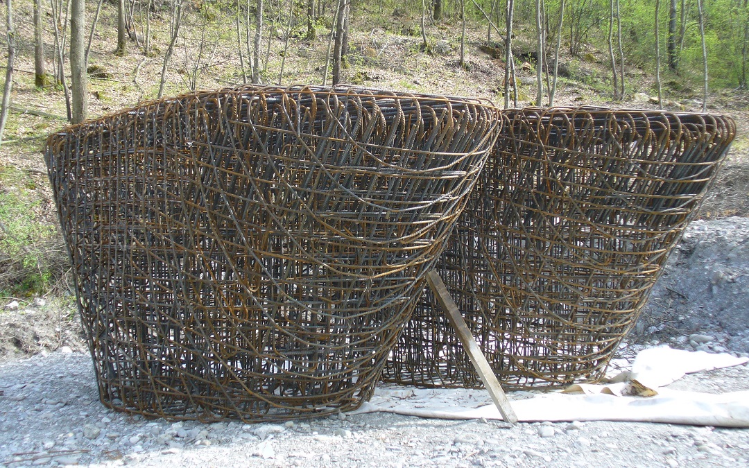
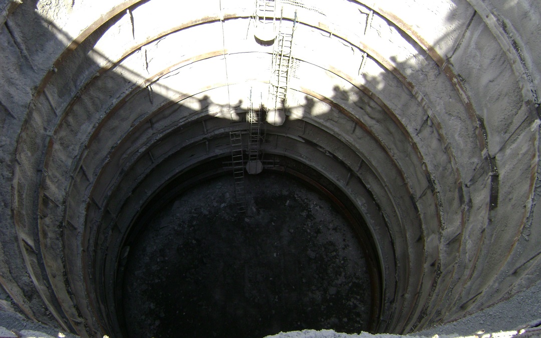
The viaduct piers have indirect well foundations for the piers located in the active bed of the Reno and pile or deep well foundations based on the geomorphic context: the most suitable solution was selected on a case-by-case basis according to in-depth studies on the slope behavior.
The infrastructure includes 6 multi-span viaducts (from 100m to 725m), 3 artificial tunnels, retaining structures (walls and bulkheads) and an important intervention to stabilize the landslide slope.


