PRO ITER Prog. Infrastr. Terr. (77%); Electrowatt Infra S.A.
The work entailed drawing up the final design for the integrated contract and performing an environmental impact study on lot 4 of the S.S.38 'Stelvio' main national road bypass which skirts around Tirano, as well as the link road to the Poschiavo customs point.
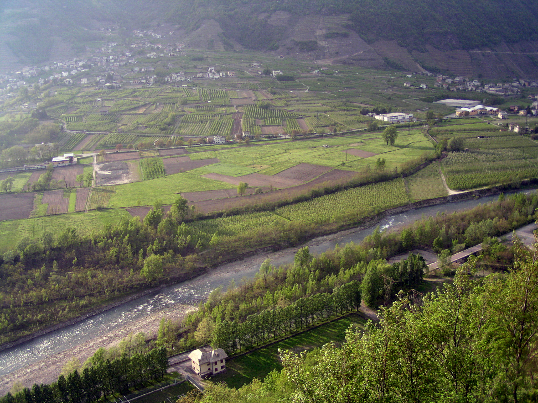
The design of the alternative route of Tirano consists in adapting the road system around town center, and is a part of the overall adaptation of the S.S.38 'dello Stelvio' from Colico to Bormio, in the province of Sondrio.
The main route, developing for a total of approx. 6 km and with 10.50 m width (type C1 - Ministerial Decree 5/11/2001), originates at the confluence of Rivalone into the Adda River and ends after Tirano in the area of Campone. In order to fully integrate the relevant lot into the existing road network, also in the absence of the other two downstream measures, the design includes the creation of two connections with the current S.S.38: a link road between Villa di Tirano and Stazzona with the junctions of Villa di Tirano and Stazzona; and a link road to the SS38 for connection with the town center of Tirano and going on to Switzerland.
Continue3 natural tunnels (2050 meters, 2000 meters, 1570 meters)
1 artificial tunnel (about 1000 meters).
4 viaducts in steel/concrete
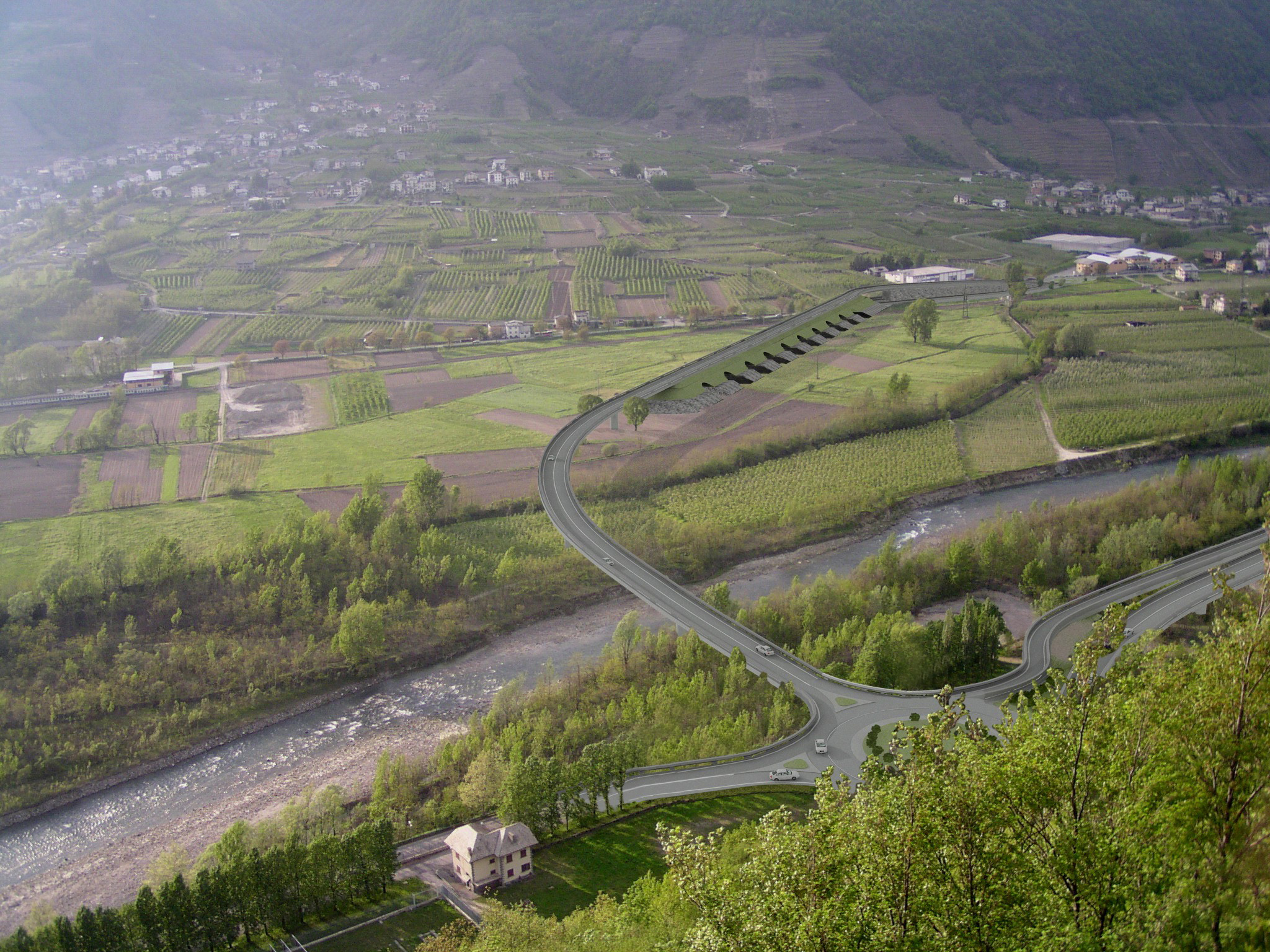

The new infrastructure consists of a few mixed steel/concrete road viaducts, necessary mainly to cross the River Adda and the Tirano junction slip roads. It also consists of 3 natural tunnels of between 1500 and 2000 m in length, as well as an artificial tunnel about 1000 m long.
Two of the three natural tunnels (Il Dosso, 2044 m in overall length, passing through metamorphic rock formations mainly consisting of mica schists and gneiss, and Cologna, 1998 m in overall length, passing through alluvial cone deposits mainly consisting of lime-sandy gravel) are on the artery which joins the Tirano junction with the Lovero junction, while the third (Ramaione Tunnel, 1560 m in overall length, passing through metamorphic rock formations consisting mainly of mica schists) will become the future branch which connects with the national border in Val Poschiavina.
Special attention was paid to the hydrogeological issues concerning a section of the Adda River and the affluent Poschiavino, characterized by a delicate hydrogeological structure. Therefore, the new works have been designed so as not to modify the watercourse system of the territory, in particular without altering the functions of the overflow and runoff areas and allowing flood runoff in the proper areas.
The main objectives of the designed system can be summarized as follows: to fill the gap in the infrastructural offer of a territory characterized by high tourist flows both in winter and in summer; to improve connection of this territory with the provinces of Lecco and Milan; to decongest state, province and municipal roads in the province of Sondrio; to improve the road link with Switzerland and the province of Brescia with the creation of two ad hoc lines; to solve the long-lasting problem of accidents affecting the area.


