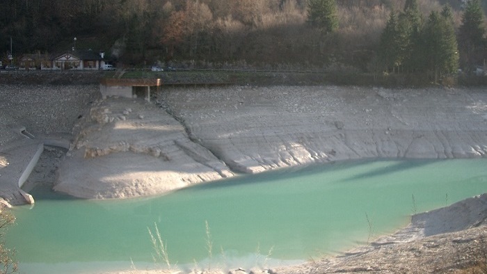
The geological-geomechanical study of the Barcis dam reservoir (Lake Aprilis), located in the east of the council area of the same name (PN), is part of the final design for the new surface outlet which ends up in the Cellina Torrent ravine.
The study entailed a geological situation report and technical analysis of the ground and rock formations affected by the construction of the new outlet, which includes the following structures:
a) Intake structure (upstream mouth 397.60 m above sea level, Aprilis lake side);
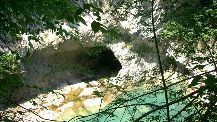
b) Water tunnel (NNW-SSE axis, gradient = 2.5%, l=270 m approx.);
c) Outlet structure (downstream outlet with fixed threshold height of 371.10 m above sea level, Cellina Torrent ravine side).
ContinueHydraulic setting (397.60 m.s.l.m.; side Aprilis lake)
270 meters long, 2.5% slope, direction NNW-SSE.
Restitution Infrastructure (threshold fixed at 371.10 m.s.l.m.; side Cellina creek)
The landscape of the area under which the tunnel passes consists of a rocky relief, with a maximum height of 452 m above sea level. The north side (lake side) has a slight slope (about 25°), whereas the left bank of the Cellina Torrent is steep, with side walls that range from subvertical to overhanging at some points. About 35 m after the north mouth (lake side), the tunnel being designed crosses the waterproofing of the north dam abutment (through a special underground passage). After that, about half way along its length, it passes just a few meters over the outlet tunnel. About 50 m NE of the underground stretch being designed is the old road tunnel owned by ANAS "Autonomous Italian Road Body" (l=170 m). It is 25 m - 30 m higher than the path of the tunnel being designed. Only two short stretches of the ANAS tunnel are lined, about 20 m from the upstream mouth and near the downstream mouth. Therefore, besides being a valid geostructural analysis tool itself, it was possible to make two geognostic bores duly inclined towards the tunnel path being considered.
The critical element in the assessment of the geological-hydrogeological conditions at the design depth is the carsic structures found on the carbonate rise underlying the tunnel. Geoelectric investigations were therefore necessary. In this way, it was possible to identify the rocks and potential risk situations for the structures being designed on the basis of the combined data from the surface measurements, the geognostic investigations, the survey inside the tunnels bordering onto the structures being designed and an analysis of the historical data shown on the papers dating back to the time the dam was built.
Due to the presence of karst structures detected on the carbonate ridge underlying the tunnel, it was necessary to perform geoelectric investigations.