PRO ITER Infrastrutture (45% - Group leader), Erre.Vi.A., Sinergo, D. Vision Architecture.
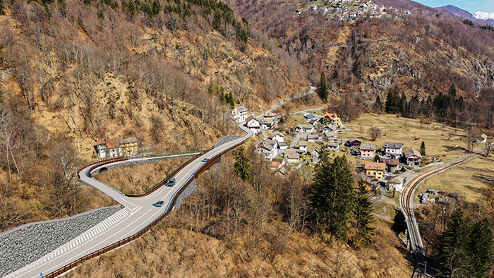
The project involves the securing of Val Vigezzo State Road n.337 in the section between the built-up area of the Re municipality (Verbania province) and the Ribellasca municipality (near the state border with Switzerland), between km 23+900 and km 29+668.
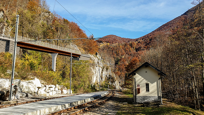
State Road No. 337 fits into a typically mountainous context characterized by the presence of numerous environmental and anthropic constraints. The area orography is complex and characterized by the presence of very steep rocky slopes (at times jutting out over the existing roadway) and by the presence of the Vigezzina-Centovalli railway (for a long stretch parallel to the existing roadway, in close flanking); the current route is characterized by high tortuosity and narrow width of the roadbed, with minimums of about 4 m.
The project involves the upgrading of the existing local roadway to a suburban-type road of category C2 with cross-border character and international significance: one lane in each direction of 3.50 m and two 1.25 m side platforms (total width equal to 9.50 m). The total development of the intervention is about 5 km: 4 km of upgrading and about 1 km of non-intervention (sections already subject to previous upgrading).
The design objective of increasing the functionality and safety of the current roadway has been pursued through the implementation of on-site upgrades and plano-altimetric variations in viaducts and tunnels.
Continue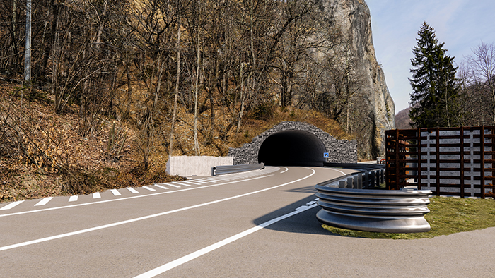
In order to ensure the safety of the longest tunnel (Tunnel "Olgia 1"), in compliance with ANAS Safety Guidelines, a pedestrian escape route located below the road platform is planned; access is guaranteed at two lay-bys, equidistant with respect to the development of the tunnel, which allowed an overall increase of the latter and, not a secondary aspect, to avoid the construction of lay-bys in the open-air sections adjacent to the portals (characterized by unfavorable morphology).
The site morphology required the widespread use of retaining works on both sides, consisting of retaining walls (on direct foundations or, more widely, on micropiles), berms lined with stone walls, cantilevered slabs, and semi-viaducts built with honeycomb structures founded on reinforced concrete baffles.
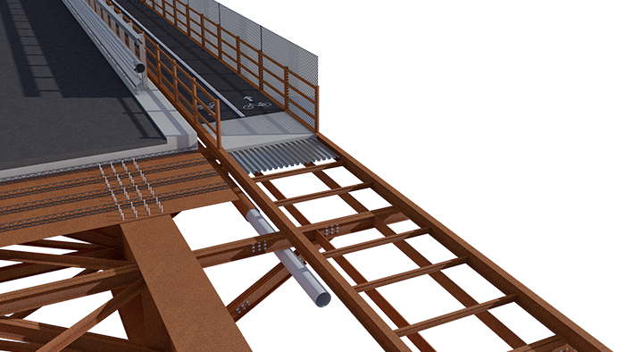
Given the highly valuable landscape context in which the work is located, special attention has also been paid to the environmental sustainability of the intervention, both during construction and operation. The project includes the redevelopment of disused sections (renaturalizing them, downgrading them to maintenance roads or earmarking them for the construction of new bicycle paths) and numerous landscape-environmental reconnection works (covering all the artworks with stone, masking the technical rooms, making connections with the existing footpaths, etc.) that contribute to the completion of the project for the redevelopment of disused sections, giving the project as a whole greater coherence with the natural environment in which the new infrastructure is inserted. Among the upgrading of the disused sections, special attention was paid to the entire section of the current roadway (bypassed by the construction of the two tunnels), which was earmarked for the construction of a bicycle path with equipped and scenic rest areas. The construction of a bicycle footbridge alongside the "Olgia 2" viaduct (located between the two tunnels and about 99 m long) ensured the continuity of the bicycle path from the southern entrance of the "Olgia 1" tunnel to the end of the intervention (near the State Border) for a total length of about 1.5 km.
Special attention has also been paid to the construction site, with the aim of limiting material movements, maximizing the reuse of excavated soil and rocks within the construction site, and reducing the impact of the work on both the environment and the population. In some of the design choices, it was necessary to ensure the operation of the current roadway for the entire duration of the work (estimated at 1350 days), albeit with alternating one-way directions in some phases, limiting traffic closures to very limited periods.
Specifically, the project involves the construction of:
- 3 bridges (L=35m, L=50m, L=51m);
- 4 viaducts (L=85m, L=94m, L=87m, L=99m);
- 2 natural tunnels (L=848m, L=270m).